21 Oct 2018 The Mountain that moved!
Forestry Commission tracks are not often welcome in the wilderness, but above the Penllyn Forest in the Berwyn Mountains lies a vast expanse of strength sapping heather moorland.
Here even walking in a straight line is a test of stamina as you stumble from one tussock to another.
But then there's the track. We've never actually seen it used for its intended purpose, but approaching these mountains from the foot of the Hirnant Pass a beautifully easy track leads uphill through the forest until you emerge from the trees.
It's a bit of a flog through the heather for the first top, Y Groes Fagl, but the summit is conveniently marked by a pole.
The track leads temptingly away westwards, but looking at the OS map there seems to be no doubt that the next objective is Cyrniau Nod. No need to do any surveying, we thought, the only competitor is Foel Cedig and that's clearly marked by the Ordnance Survey as a metre lower. Have you noticed that when two summits are about the same height it's always the other one that looks higher. So of course Foel Cedig looked higher. We stumbled our way back to the track and thought no more about it.
That is until Myrddyn Phillips went to have a look. His "Trimble" (a sophisticated GPS) said the OS had got their measurements muddled and Foel Cedig is actually higher than Cyrniau Nod. We really need the OS to agree, otherwise we'll be forever answering emails telling us we've got it wrong, so we asked John Barnard and Graham Jackson.
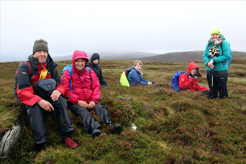
We've now had the good news. The Ordnance Survey agree with Myrddyn and we can safely delete Cyrniau Nod. So if you want to see the new summit at its best then go in August for the heather is magnificent. As you can see from the picture we had a party there this summer.
The track leads temptingly away westwards, but looking at the OS map there seems to be no doubt that the next objective is Cyrniau Nod. No need to do any surveying, we thought, the only competitor is Foel Cedig and that's clearly marked by the Ordnance Survey as a metre lower. Have you noticed that when two summits are about the same height it's always the other one that looks higher. So of course Foel Cedig looked higher. We stumbled our way back to the track and thought no more about it.
That is until Myrddyn Phillips went to have a look. His "Trimble" (a sophisticated GPS) said the OS had got their measurements muddled and Foel Cedig is actually higher than Cyrniau Nod. We really need the OS to agree, otherwise we'll be forever answering emails telling us we've got it wrong, so we asked John Barnard and Graham Jackson.
We've now had the good news. The Ordnance Survey agree with Myrddyn and we can safely delete Cyrniau Nod. So if you want to see the new summit at its best then go in August for the heather is magnificent. As you can see from the picture we had a party there this summer.
Seven Nuttalls on the summit